Tajikistan Travel Guide
‘Roof of the World’ Pamirs and the breathtaking lakes and pinnacles of the Fan Mountains all contribute to making Tajikistan arguably Central Asia’s most exciting destination.
Tajikistan is a landlocked country in Central Asia that borders Afghanistan to the south, Xinjiang in China to the east, Kyrgyzstan to the north, and Uzbekistan to the west and northwest. The ancient Silk Road passed through it. Tajikistan’s awesomely dramatic highland landscapes are now testing playgrounds for hardy climbers, trekkers and adventure travellers. Nascent rural homestay programs mean you might stay in timelessly photogenic rural villages hosted by gold-toothed, white-bearded patriarchs in iridescent joma robes.
Fast navigation
Destination Highlights
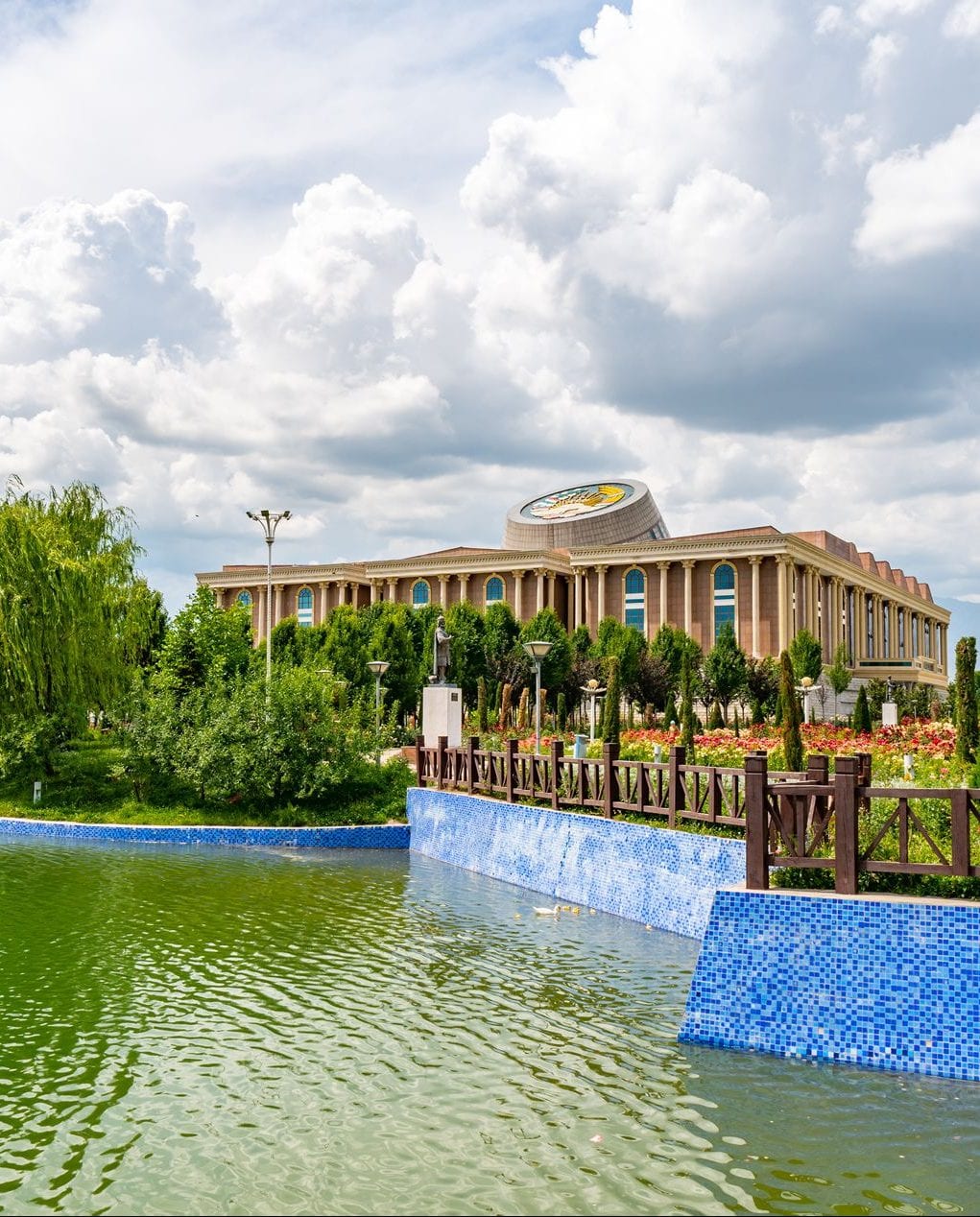
DUSHANBE
With a rural hinterland of grassy pastures and snow-capped mountains visible from down town, Dushanbe is a delightful city built around parks, lakes and fountains. With the frenetic building project of the past decade mostly complete, there is a palpable air of satisfaction about the city centre. Its grand plane tree boulevard, Rudaki, threads past pastel-hued remnants of the Soviet era and just as proudly past the modern icons of statehood. Chief of these is the golden statue of 10th-century Ismoil Somoni presiding over Friendship Square, representative of the sense of renaissance that marks the current era.
National Museum
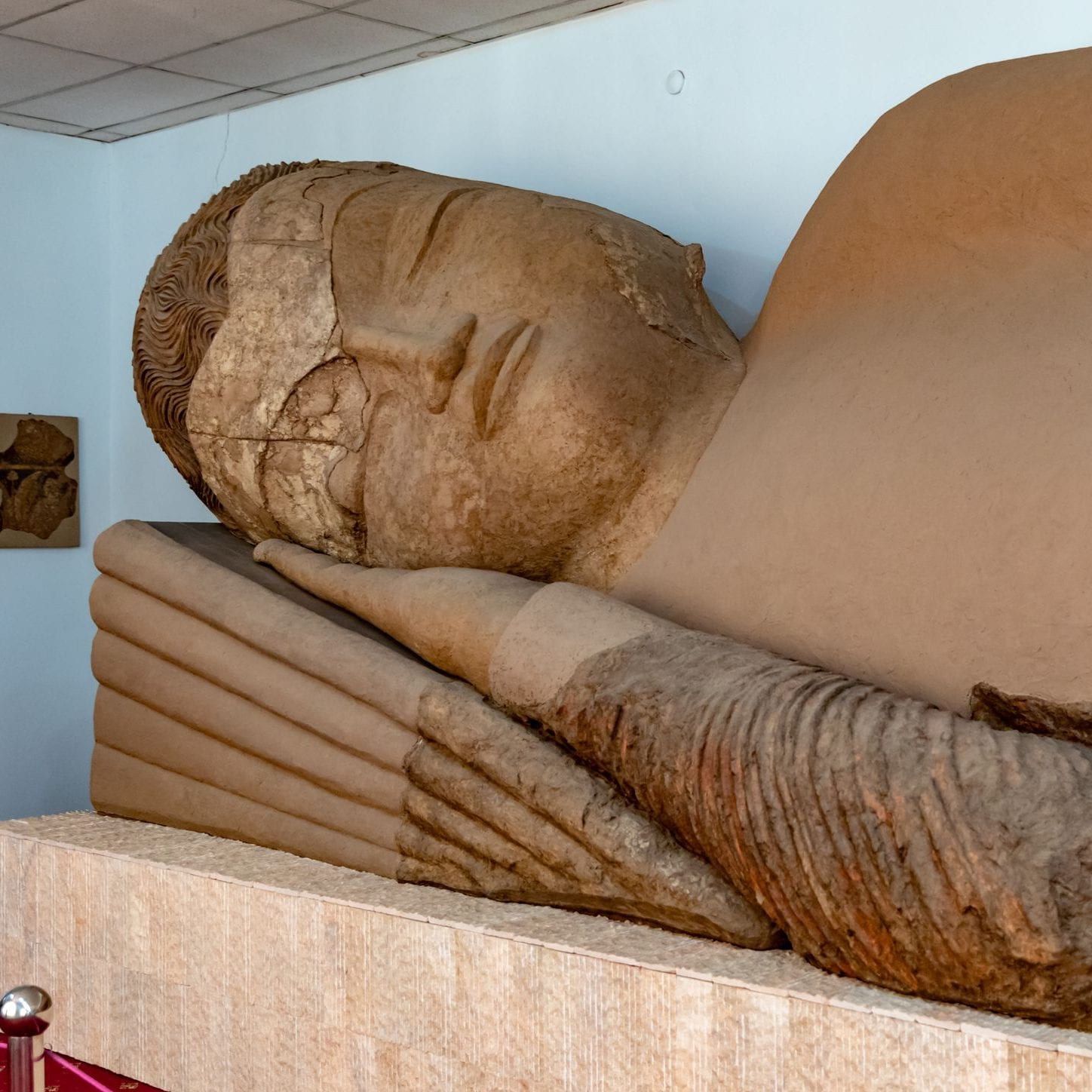
Opened in 2013, the impressively airy National Museum is especially strong on archaeological exhibits, both real and recreated. The reconstruction of the Ajina-Tepe Buddhist monastery site is particularly successful in conjuring up the feeling of how the 7th-century original might have appeared.
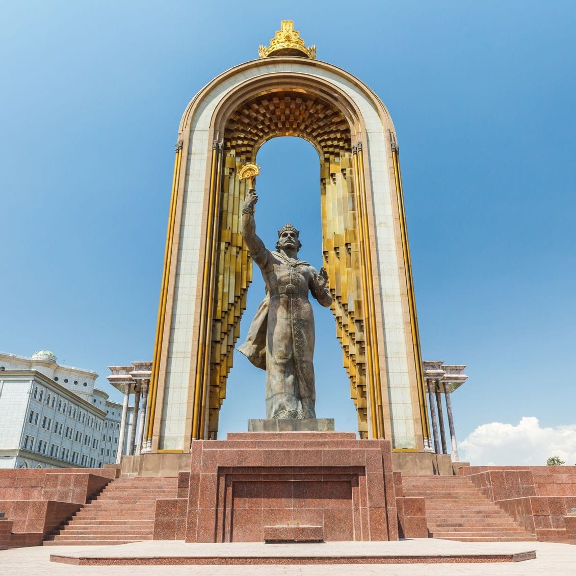
Statue of
Ismoil Somoni
Dushanbe’s most visible monument to nation-building sees the 10th-century founder of the Samanid dynasty emerging through a giant crowntopped theatrical hoop waving a wand. Rising behind him, the Parchan is a goldtopped white-marble column reminiscent of a Roman centurion’s standard.
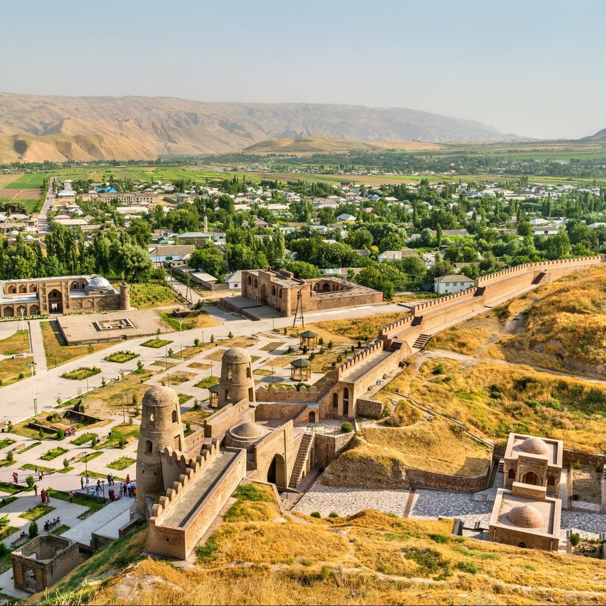
Hissar Fort
Pictured on the 20TJS banknote and just 30km west of Dushanbe, the remains of this 18th-century fort make for an interesting day trip from the capital. All that survived a 1924 Russian assault is the twin-towered gateway but the site has plenty of atmosphere, not least as it is a popular escape from the city for locals. A 17th-century madrassa at the site contains a small museum with a fascinating relief model of Tajikistan demonstrating its 93% mountainous coverage.
National Museum
of Antiquities
The statue of the Sleeping Buddha, found in Ajina-Tepe Monastery remains, is one of the most legendary exhibits of the National Museum of Antiquities of Tajikistan in Dushanbe: it is a 13-meter high clay statue of a reclining Buddha fashioned from a statue of a deity.
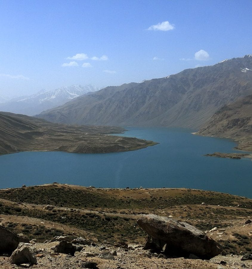
Nurek Reservoir
Nurek Reservoir is 70km long and the second tallest man-made dam in the world. Its remarkable opal-blue water, set within a pastoral landscape and edged with mountains, is a striking sight from the A385 – the main highway south from Dushanbe. The dam is located in a deep gorge along the Vakhsh River in western Tajikistan, about 75 km east of the nation's capital of Dushanbe. A town near the dam, also called Nurek, houses engineers and other workers employed at the dam's power plant.

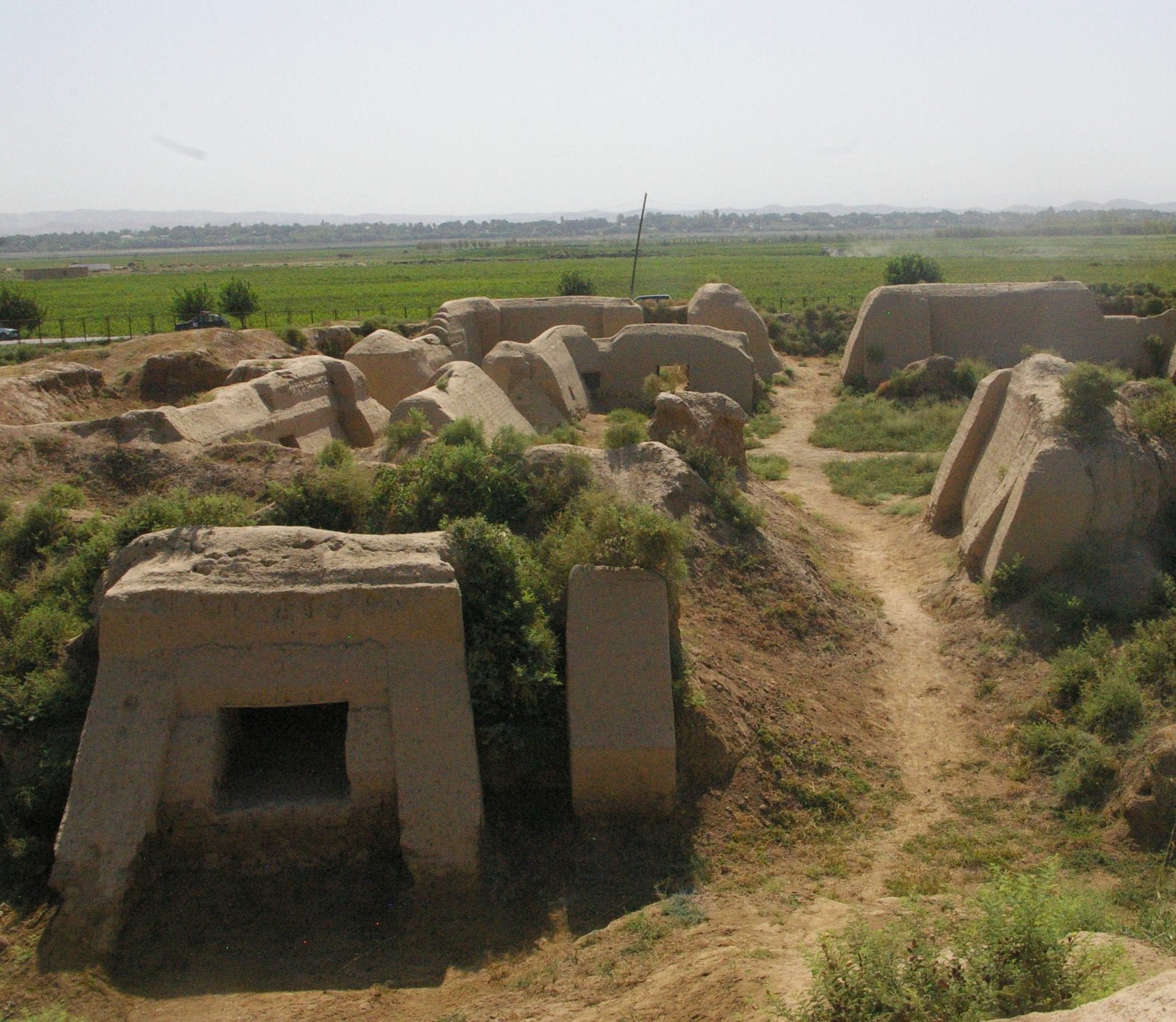
Ajina-Tepa
Located 115 km (south) from Dushanbe is the district named by local inhabitants as Ajina-Tepa. It can be translated as «the Devil's hill", "the Hill of Evil Spirit". It came out as a surprise when archeological excavations which started in 1961 resulted in 500,000 artifacts: sculptures, reliefs, wall painting fragments of a uniform complex of dwelling and cult rooms belonging to the 7th - 8th-century Buddhist monastery. The most sensational find here became a huge clay statue of the Buddha in nirvana, that nowadays everyone may see at the Museum of Antiquities in Dushanbe.
Penjikent
Located in the middle of the western arm of the Zerafshan Valley, the rural city of Penjikent sits on a rare piece of flat ground in the middle of high mountains. With an ancient history extending back to Silk Road days, and famed for its connection with beloved poet Rudaki, the city boasts an archaeological site, a worthwhile regional museum and a lively bazaar. Penjikent is famous for its millenium-old archaeological site, as a springboard for Haft-Kul, and nearby heights of Fann Mountains. In the days when the border with Uzbekistan was open to foreigners, Penjikent attracted many tourists from Samarkand, Uzbekistan.
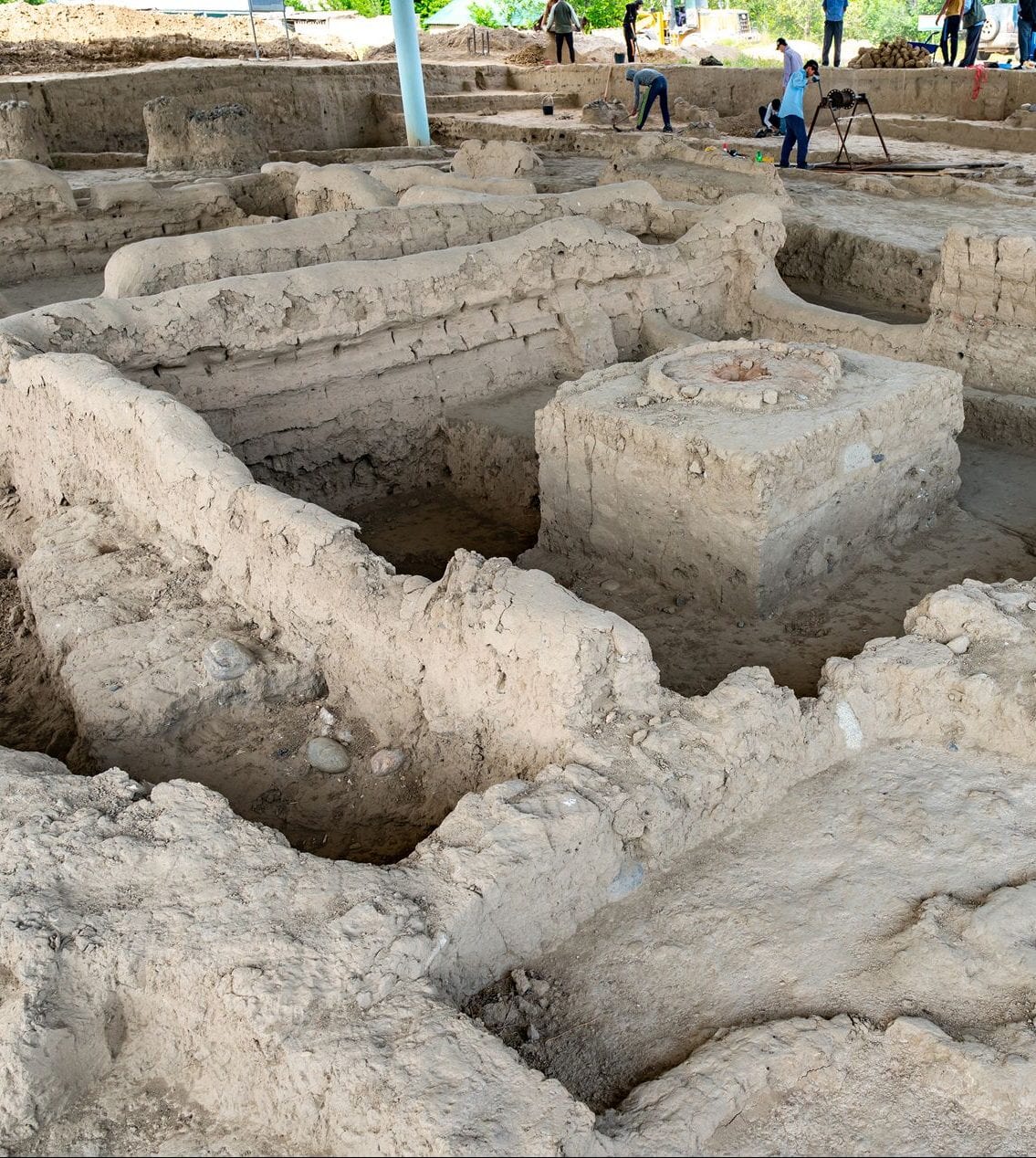
Sarazm Settlement
Sarazm is a settlement dated the 4th -2nd millennia BC with survived temples of fire, public and residential buildings, cult and palace structures. A lot of objects made of copper, bronze, lead, silver and gold; armor, jewelry related to 4th - 2nd millennia B.C. were found there. The settlement stands on a height extending from west to east on the left bank of the Zeravshan River. The total area of the settlement exceeds 100 hectares.
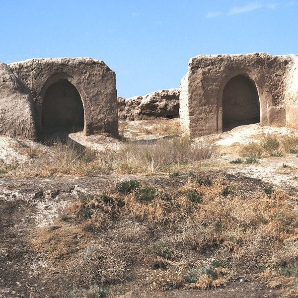
Ancient Penjikent
In the suburb of modern Penjikent located the true picture from the past: the medieval citadel surrounded by dwelling buildings with wall paintings; near the ancient settlement center stands the necropolis. The local residents call this place "Kainar" which is also the name of the nearby water spring. The archaeological excavations were started there at 1946.
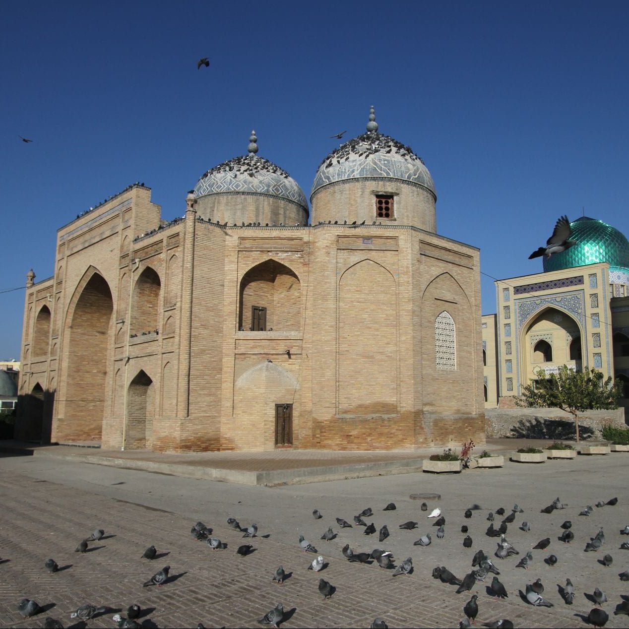
KHUJAND
Khujand is Tajikistan’s second-largest city. Crossing the Syr-Darya River near the point where Alexander the Great once founded his northernmost Central Asian outpost, Alexandria-Eskhate. Commanding (and taxing) the entrance to the Fergana Valley, Khojand built palaces, grand mosques and a huge citadel before the Mongols bulldozed the city into oblivion in the early 13th century. Several sparkling new monuments add to the air of comparative prosperity, the bazaar and mosque complex is impressive, and there are a few historical curiosities to glimpse as you transit between Kyrgyzstan or Uzbekistan and the Fan Mountains.
Citadel
& History Museum
The city’s oldest remains are the formless baked-earth walls of the 10th-century citadel, which once boasted seven gates and 6km of fortifications. Earlier this had been the site of Alexander the Great’s original settlement. That’s where the rebuilt bastion now contains a museum, lavished with colourful stone mosaics and partly 3D murals though it contains little in the way of historical artefacts.
Sheikh Massal
ad-Din Complex
In striking comparison to the bazaar opposite, this religious complex comprises the 1394 brick mausoleum of Sheikh Massal ad-Din (1133–1223), covered porticoes with carved wooden pillars, a 20th-century mosque with sensitive, if modern, white-stone frontage and a 21mhigh brick minaret dating from 1865. A matching second minaret is nearing completion directly north, attached to a new, traditionally designed brick mosque that looks archetypally Central Asian but for the luridly reflective emerald-green dome.
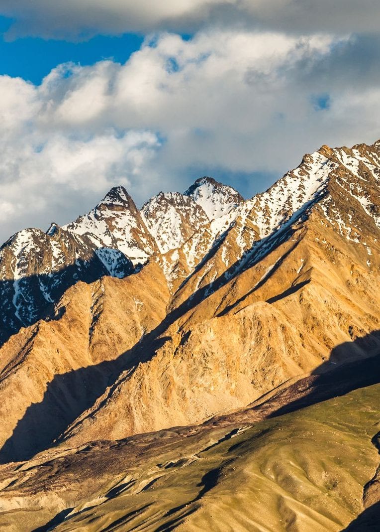
Fan Mountains
In the northwest of the country, 30km east of Penjikent, the Fan Mountains are a beautiful range of sharp-peaked mountains, many snow-capped around the year, that offer many popular hiking opportunities.
The main M34 between Dushanbe and Khojand winds through the fringes of the range, and gives access to beauty spots, beautiful Iskander-Kul lake, dramatic Margeb and the timeless Yagnob and Zerafshan valleys all make great summer excursions.
The best time for visiting is late June–mid-September for trekking and July – August for mountaineering, when the weather is usually at its best.
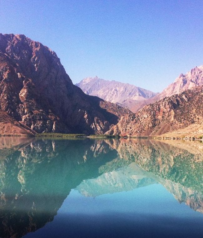
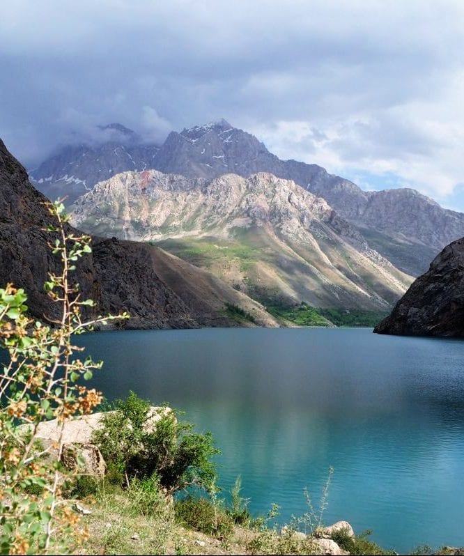
Iskander-Kul Lake
Iskander-Kul, an opal-blue mountain lake that looks almost tropical in strong sunlight, but it isn’t. At 2195m, don’t expect to swim here. But adding greatly to the visual spectacle is the variegated colouration on the superlative mountain backdrop. The name of Iskanderkul Lake means the Lake of Alexander the Great, where “Iskander” - this is how Alexander the Great was named in the East and “kul” means lake in Turkic languages.
Fan Mountains
Fan Mountains are part of the western Pamir-Alay mountain system and are primarily located in Tajikistan's Sughd Province between the Zarafshan Range to the north and the Gissar Range to the south. Famous with its lakes, the Fanns also boast about a hundred peaks, with several rising to altitudes of more than 5,000 meters and relative elevations of up to 1,500 meters.
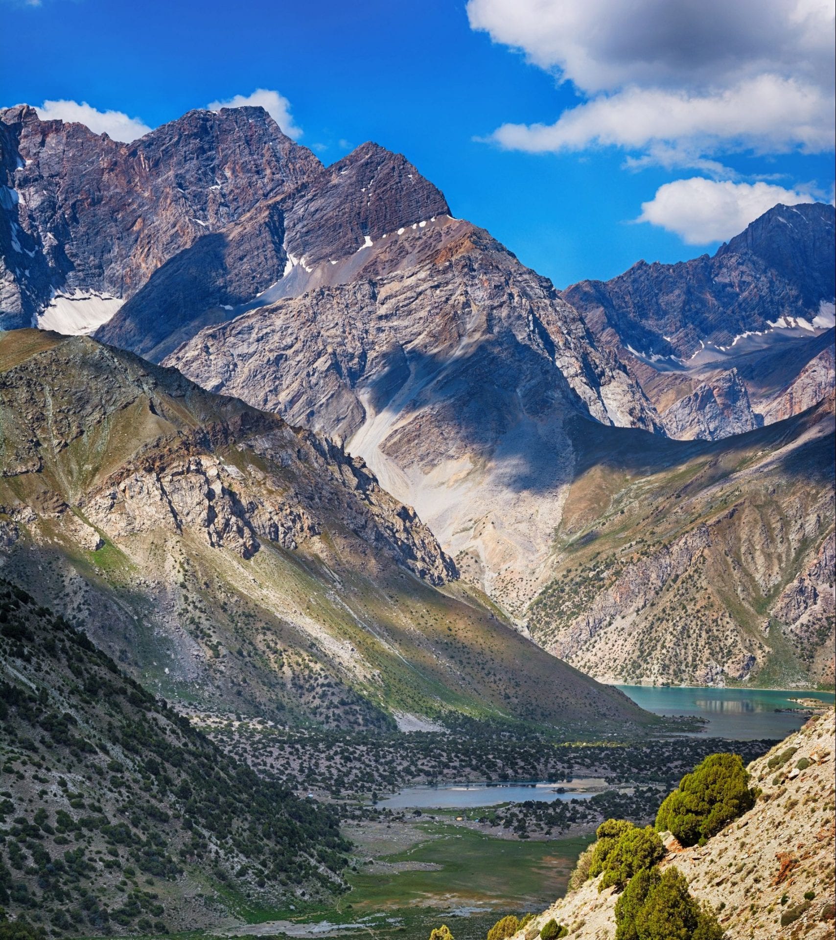
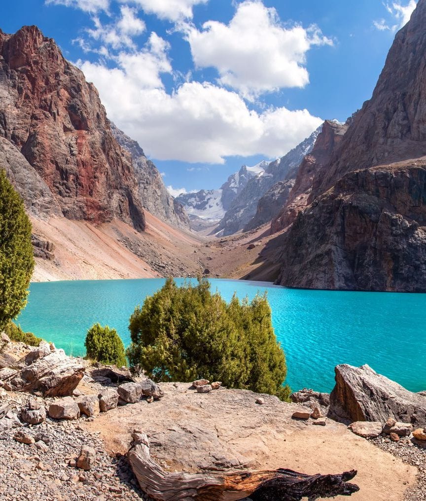
Alaudin Lakes
Limpid and dreamily beautiful, the main Alaudin Lake (2780m) is a glorious place for camping, and a possible base for walking into the heart of the Fan Mountains. A popular day hike takes you out to Mutnye (muddy) Lake (3510m), surrounded by a splendid array of 5000m plus peaks. Alaudin is helpfully accessible, just 3km on foot from a trailhead camp where three valleys meet.
Haft-Kul Lakes
Haft-Kul or Seven Lakes, Marguzor Lakes, refers to a spectacular 20km chain of pools strung along the western edge of the Fan Mountains. The first lake is an astonishing azure blue, the next four are aquamarine and the sixth is a pale turquoise. And the final lake needs to be seen to be believed.
The Pamirs
The Pamirs Area located in Gorno-Badakhshan (eastern Tajikistan) is almost a different country and indeed it has its own special entry requirements. Officially called Kohistani Badakhshan, though commonly abbreviated to GBAO, the region accounts for 45% of Tajikistan’s territory but only 3% of its population. Most of the 212,000 souls who do live here are Pamiris whose irrigated villages lie deep within dramatic rocky valleys above which snow-dusted mountain peaks rise. The eastern region, however, is mostly a stark moonscape plateau, at an altitude of well above 3000m, sparsely populated with Kyrgyz herders whose sheep and yaks eke out an existence in those areas fertile enough for grass to grow. Locals romantically nickname the region Bam-i-Dunya (the Roof of the World).
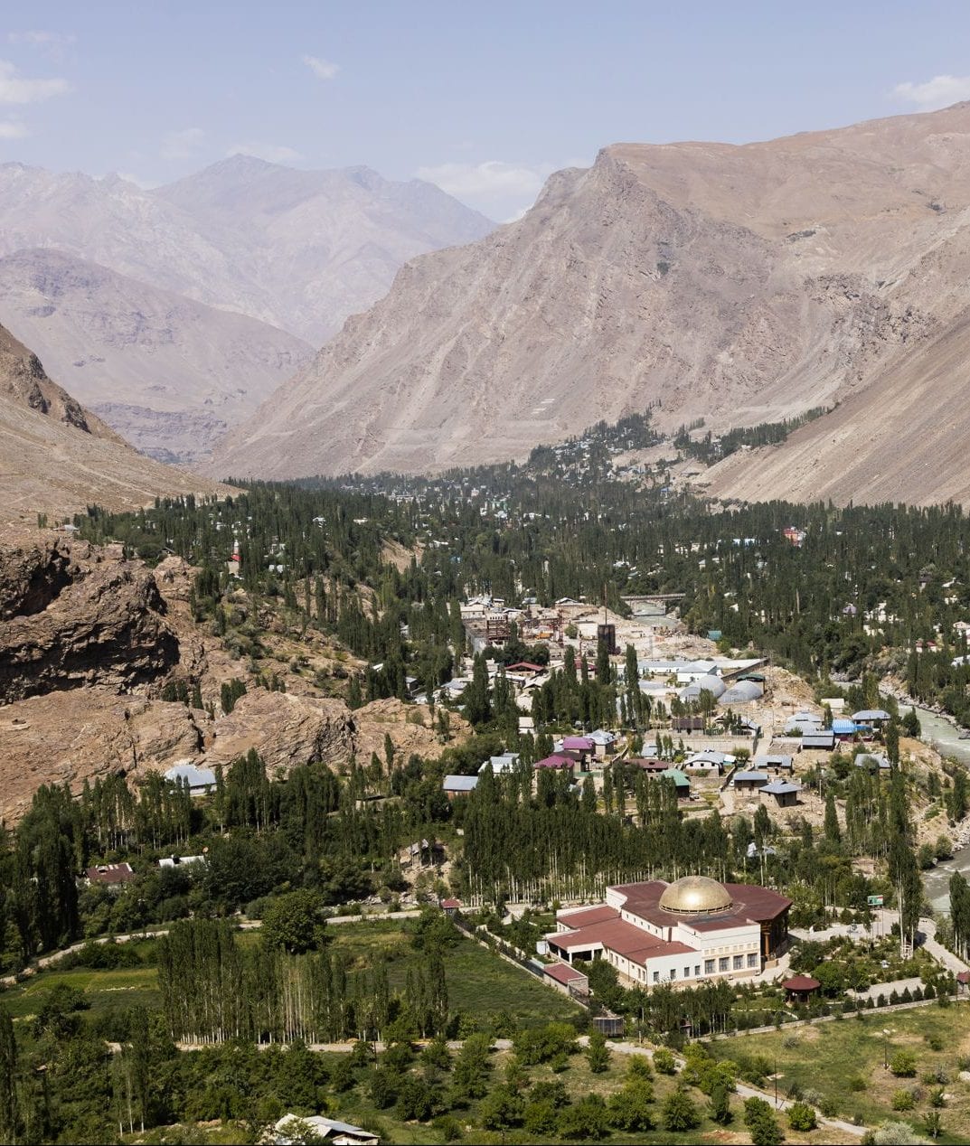
Khorog
The administrative centre of Gorno Badakhshan and the Pamirs' largest town, it has the air and confidence of a capital, attracting people from far and wide to its well-stocked bazaars, supermarkets and teahouses. One of the best parts of a visit is not nosing around forgotten museums but sitting in the beautiful, tree-filled park being part of the general sense of well-being occasioned by reaching this oasis of plenty in a land of limited resources.
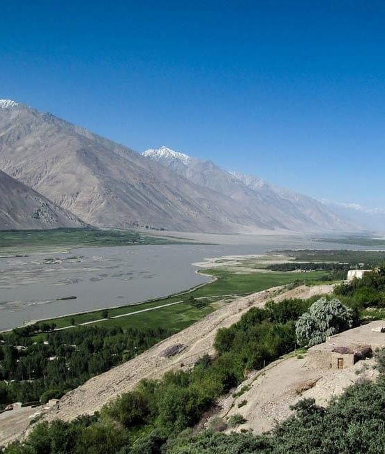
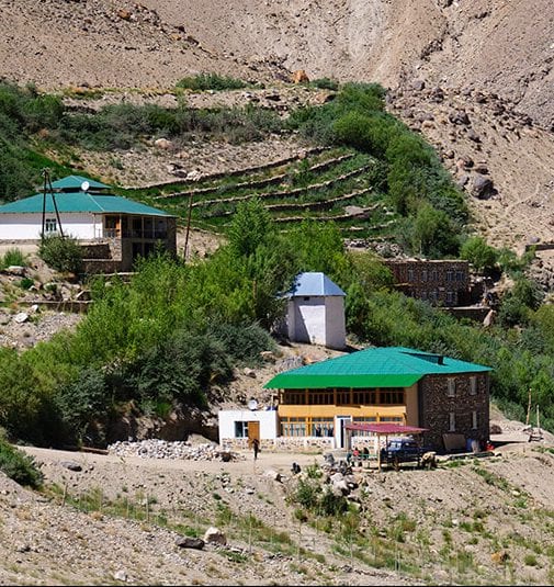
Wakhan Valley
The Wakhan offers up a seemingly endless parade of scenic superlatives. Vivid green villages counterpoint towering valley walls, which open regularly for glimpses of the dazzling white Hindu Kush mountains marking the Afghanistan–Pakistan border. A sprinkling of castle ruins and ibex-horn shrine-walls, even a Buddhist mini ziggurat-stupa, add zest.
Yamchun Fort
The 12th-century Yamchun Fort is the most impressive of the Wakhan valley’s many tumbledown castle ruins, complete with multiple walls and round watchtowers. The site is a 6km switch-backed drive from the main road and sits about 500m above the valley. Climb up the hillside west of the fort for the best views.

Bibi Fatima Springs
About 1km further uphill from the Yamchun Fort are the Bibi Fatima Springs, probably the nicest in the region and named after the Prophet Mohammed’s daughter. Women believe they can boost their fertility by visiting the womblike calcite formations. Men’s and women’s bath times alternate every half hour.
Vrang
On an obvious salt-bleached patch of mountainside directly behind Vrang is a five-level stone monument claimed to be an ancient Buddhist stupa, though it looks more like a miniature ziggurat (stepped pyramid). This stupa also may have originally been a Zoroastrian fire temple.

Bulunkul & Yashilkul
Yashilkul is a freshwater lake, lying in the upper Gunt valley of the Pamir Mountains, it has an area of 3,600 hectares with a maximum depth of 52 metres. It lies 1.5 kilometres (0.93 mi) from a similar lake, Bulunkul, both of which are surrounded by other wetlands as well as sand and pebble plains. The lake forms part of the Bulunkul and Yashilkul lakes and mountains, important bird area.
Langar
A glorious knot of jagged peaks rise above Langar where the Pamir and Wakhan Rivers join to form the Pyanj River. The village comprises a collection of homesteads scattered through the valley, and the broad open vistas this sudden piece of level, fertile land offers comes as something of a relief after hours of travel through the narrow Wakhan Corridor or across the semi-arid Pamirs.

Murgab
The desolate town of Murgab fascinates as an example of life lived in extremis. The people here are used to a hard life, freezing cold in winter and furnace hot in summer. On exceptionally clear days, the snowy hulk of Muztagh Ata (7546m) hangs like a cloud upon the eastern horizon, above the dust storms that whirl around the dedicated plain below.